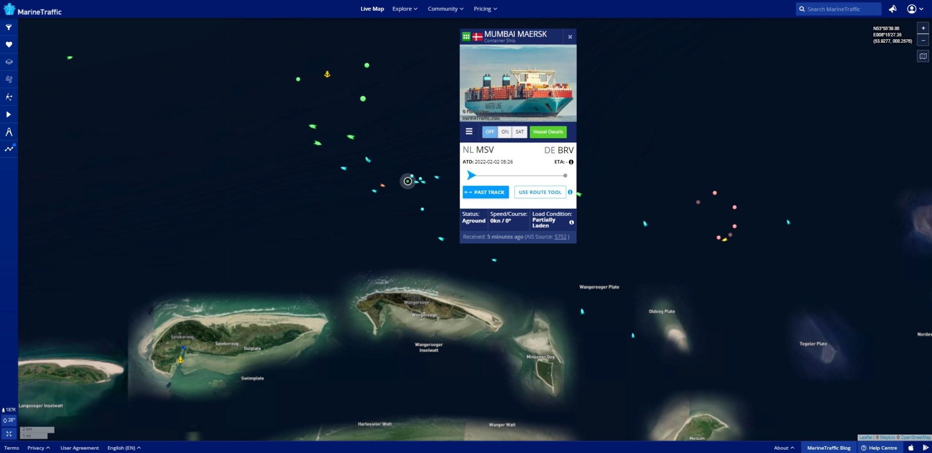
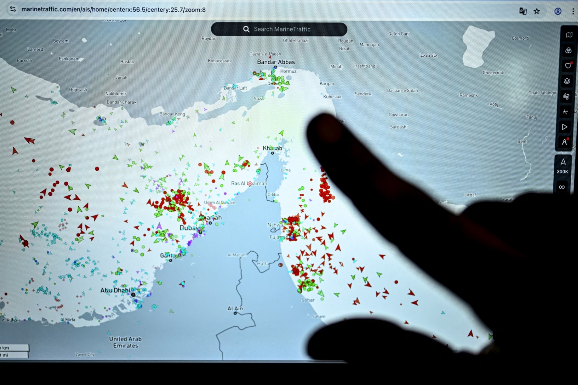
The seas now find themselves centre-stage in how people monitor the US-Iran war, view the potential for escalation, and assess its spillover effects on global trade and supply chains. As crises intensify in the Strait of Hormuz, tracking apps like MarineTraffic and VesselFinder—once the purview of those working in shipping, ports and insurance—are increasingly viewed by regular people who just want to observe ship movements and what they mean for the conflict and global trade.
Most commercial vessels transmit signals through a system known as the Automatic Identification System, or AIS. The system was originally designed to help vessels identify one another’s positions, reduce the risk of collision, particularly along crowded routes and in ports and coastal waters, and support emergency and rescue operations.
Every signal sent by a vessel carries a cluster of details: the ship’s name, position, speed, direction, type and, at times, its destination port. Tracking apps then collect that data from ground receiving stations near coasts, ports, and straits, as well as from satellites that capture signals on the high seas and reorganise them into accessible maps, where ships appear as moving points.
Typically, this data passes largely unnoticed beyond shipping and navigation circles. But in moments of tension, it can offer critical political and economic insights. Observers look not only at a vessel's positioning but also at its movements and what they suggest.
Their simplicity is what makes them so popular. Users don't need extensive technical knowledge to observe congestion outside a sensitive maritime corridor, a change in an oil tanker's route, or an area suddenly emptied of movement.
Analytical value
Some apps also link vessel movements to additional data on ownership, flag, voyage history, previously visited ports, and possible cargo, making them a very important analytical tool for journalists, researchers, and intelligence analysts. But apart from open-source apps like MarineTraffic, VesselFinder and FleetMon, there are data collection companies like Spire Maritime and ORBCOMM that provide global tracking data beyond the signals received from shore. These companies own the raw data, which makes them key to the information chain and extremely powerful.
Even when a vessel switches off its AIS, it does not disappear entirely, although it becomes harder to track on public apps. These apps depend chiefly on signals transmitted by the vessel itself, so users usually see only the last known position before a gap emerges. More advanced platforms, however, can compare the last known route with the vessel’s speed and direction, while also drawing on satellite imagery, port data, previous voyage records and the movement of nearby ships to estimate what has happened.
Switching off AIS, therefore, is not necessarily evidence of covert activity. It may be due to a technical fault, security concerns or weak coverage. In zones of tension, however, such as straits or oil routes, it becomes an important indicator that must be read alongside other sources.
Then comes the third layer: maritime analytics and intelligence companies. This is where names such as Kpler, Windward, Vortexa, Lloyd’s List Intelligence, Pole Star Global and Veson Nautical come into view. These companies sell interpretations of maritime movements, linking them to the oil and gas trade, attempts to evade sanctions, supply-chain disruption, insurance risks, and tension in sensitive sea corridors.

Commercial value
In this sense, these tracking apps serve as tools for data analysis. The public may see MarineTraffic or VesselFinder on a phone, but the greater commercial value lies behind the screen: satellite data, paid subscriptions, energy analytics, sanctions-compliance services and risk products purchased by companies, governments and financial institutions.
In April 2026, the MarineTraffic app had around 8.5 million users, up from about 3.5 million in April 2025, showing its growing popularity and utility. It also generated nearly $1mn in revenue between March and 27 April, compared with roughly $346,500 during the same period a year earlier. At the parent company level, Kpler expects to generate between $300mn and $400mn in annual recurring revenue.