

Kathmandu: The rains had briefly quelled, and beneath a bright mid-morning sky, 43-year-old Subash Tamang was working along the banks of the monsoon-swollen Trishuli River with his family. They were extracting sand, as they had done before, when the river suddenly rose to consume them.
Some 72 kilometres north, high in the Himalayas along the Nepal-Tibet border, a large section of a glacier had collapsed, sending a torrent of water, sediments, and boulders and swallowing downstream settlements. It took the flood barely 30 minutes to reach Tamang’s village in Nuwakot district, hitting with the terrible speed of a tsunami.
Tamang survived by holding on to a patch of weed. But it swept away his wife, his two brothers and their wives, and his elder sister. The body of one of his brothers has been retrieved, while the five other family members remain missing. Tamang was ferried to Kathmandu for treatment two days later.
“I have lost everything,” he said from a hospital bed. “We did not receive any warning and were not expecting the water to rise that high. One moment I was hanging by the weeds, and the next moment when I looked, none of my family members were there. I now have a hole in my leg and my heart.”
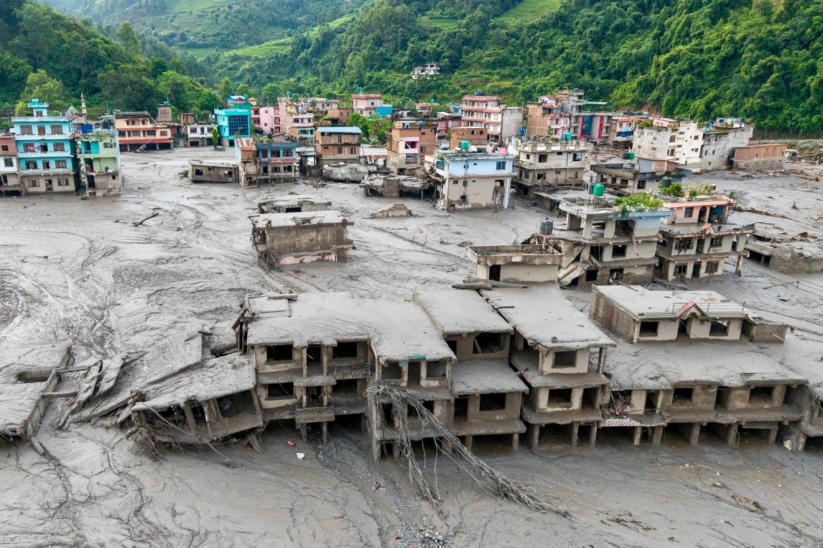
The 26 August flood has obliterated parts of three districts—Rasuwa, Dhading, and Nuwakot—in north and central Nepal, but the shock has reverberated throughout the country. The death toll from the flood has climbed to more than 1,000, with nearly 4,000 people still missing, of whom nearly 600 are foreign nationals, many of them pilgrims to Tibet’s Mount Kailash, revered by both Hindus and Buddhists.
As quickly as disaster hit, such cataclysmic events have been decades in the making. Carbon emissions have steadily warmed the Himalayas and destabilised its glaciers. A February study shows that the temperatures in Nepal’s glacier collapse area have increased 4.7 degrees Fahrenheit since 1940, twice the average global warming rate.
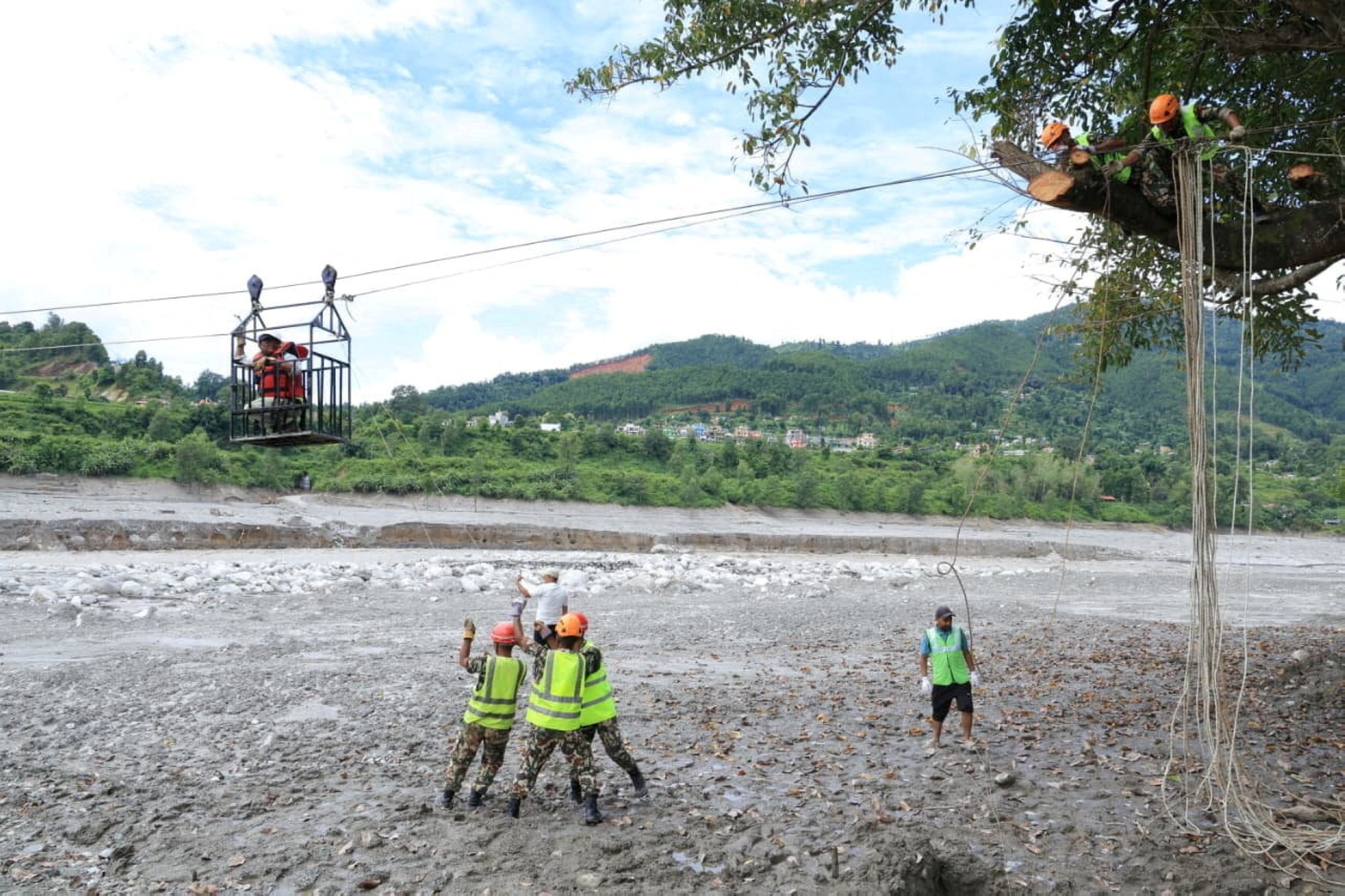
Low-income countries in the Hindu Kush—which stretches roughly 3,380 kilometres across eight countries, including Nepal—are paying a grim price for a climate crisis they did little to create. Floods and landslides have become routine and largely normalised despite significant loss of life and economic damage, but a disaster on this scale poses harder questions.
“The ecosystem and landscapes have evolved over geological time, but carbon emissions are changing them so quickly that they are adapting on a human-dominated time scale,” Simon Cook, a geoscientist and senior lecturer at Scotland’s University of Dundee, told Foreign Policy.
Almost a week after the event, scientists, including three Foreign Policy spoke with, have determined what caused the 26 August disaster: a rock-ice avalanche. The glacial collapse and landslide occurred on the northern face of Langtang Lirung peak—the 99th highest peak in the world—on the Nepali side bordering Tibet, around 8:37 a.m. Satellite images show that a 2,000-foot-wide mass of rock and ice fell from an elevation of 17,000 feet to around 4,000 feet in the valley below.
Basanta Raj Adhikari, director at the Centre for Disaster Studies at Kathmandu’s Institute of Engineering, told Foreign Policy that his estimates show it took about nine minutes for the water and debris from the landslide to reach the Rasuwa border checkpoint, about 19 kilometres from the site of the glacier collapse. That is where waves—potentially as high as 1,500 feet in some places—crashed into the border buildings, hotels, and houses in Gyirong Port on the Chinese side and Rasuwa, crushing people running for their lives—all captured in unsettling CCTV footage.
“The rock is holding the ice, and when it fell, both the rock and ice mass broke off, triggering a rock-ice avalanche,” Adhikari said. “Its mass could be over 300 million cubic meters—the size of nearly 120,000 Olympic-sized swimming pools—from our estimate. The energy it created is more than the atom bomb that fell in Hiroshima.”
The thud was so immense that it created a 5.2-magnitude tremor—which the US Geological Survey initially believed to be a 4.4-magnitude earthquake—with the debris blocking the Lhende Khola, a tributary of the Bhote Koshi River, flowing through villages such as Timure and Syabrubesi, before merging into the Trishuli River system. When it burst, an enormous volume of water was released, roaring past the trading posts and villages, which Adhikari said could have been flowing at about 161 kilometres per hour downstream.
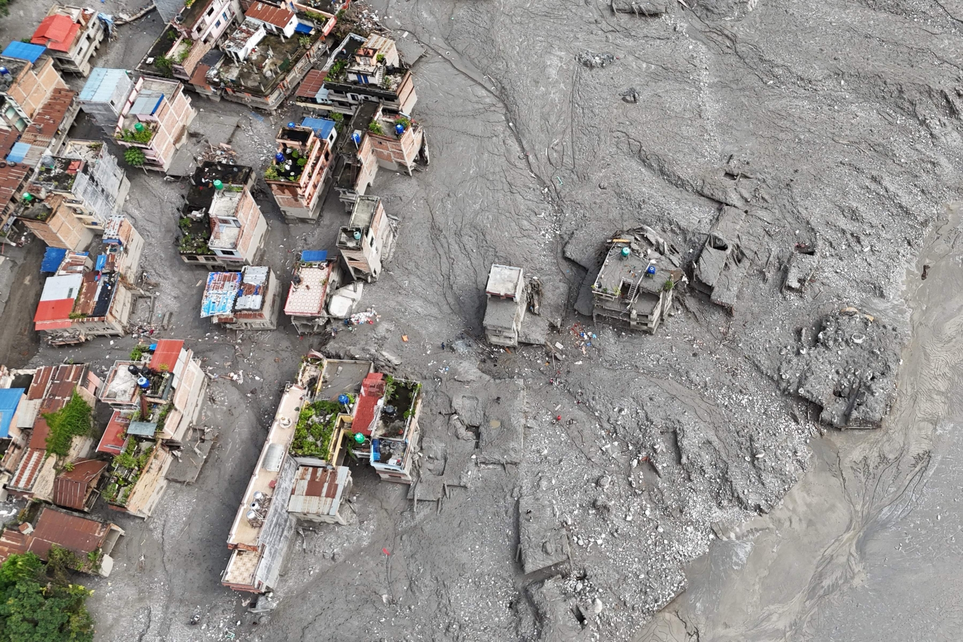
Cook said the potential energy stored in the substantial block of ice gets converted into kinetic energy when it falls, with “all that material being pulverised and broken into smaller pieces of ice slush and water.”
“There were possibly dead and decaying glaciers, too, downstream, which could have been pulverised into the flowing mix of ice, rock, boulders, and so on,” he said. “Some sort of snowmelt or water within the glaciers we did not see—it is common for glaciers to contain pockets of water—could also have resulted in the water flow. Also, the narrow constriction created a funnelling effect, resulting in huge waves enveloping buildings.”
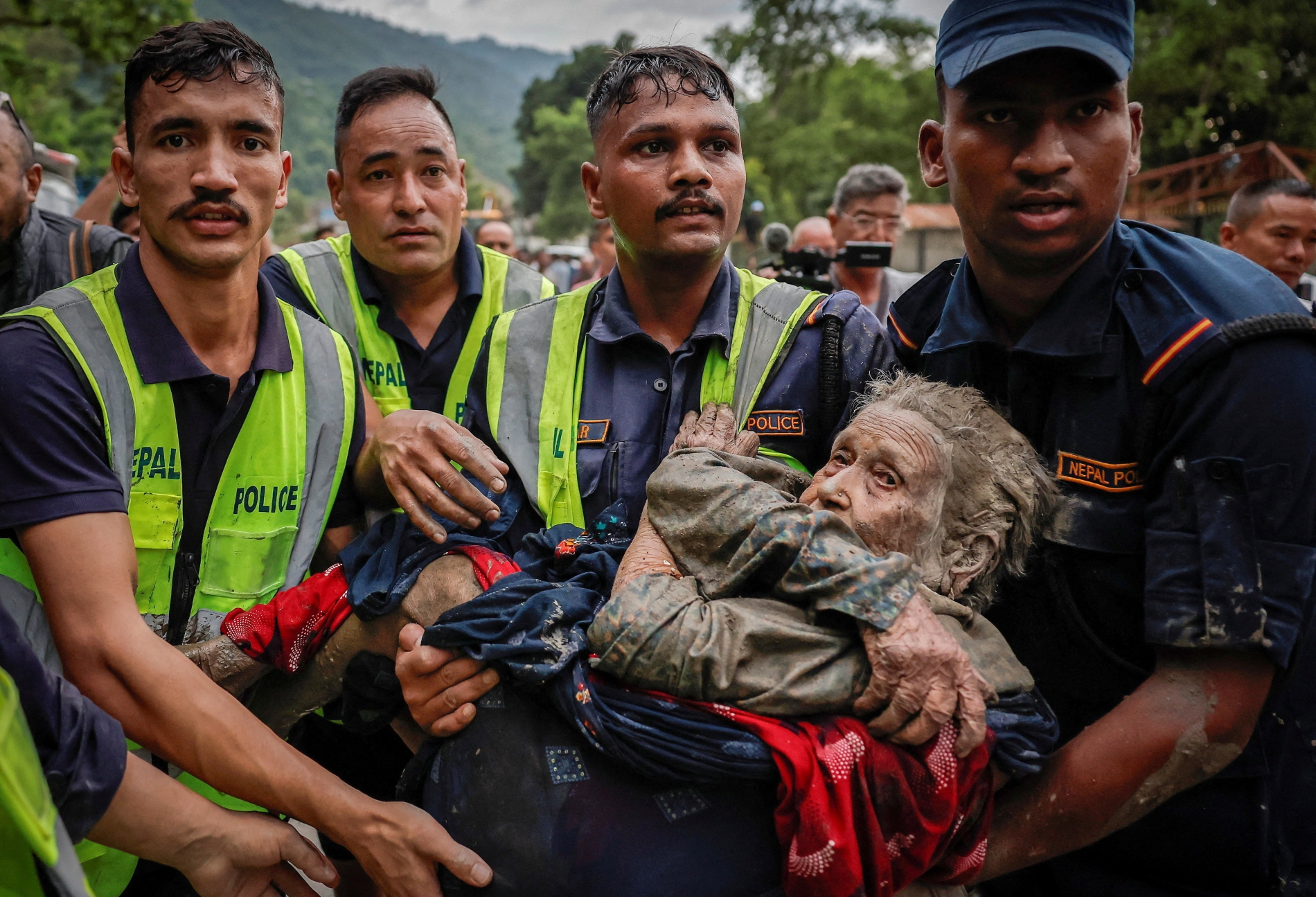
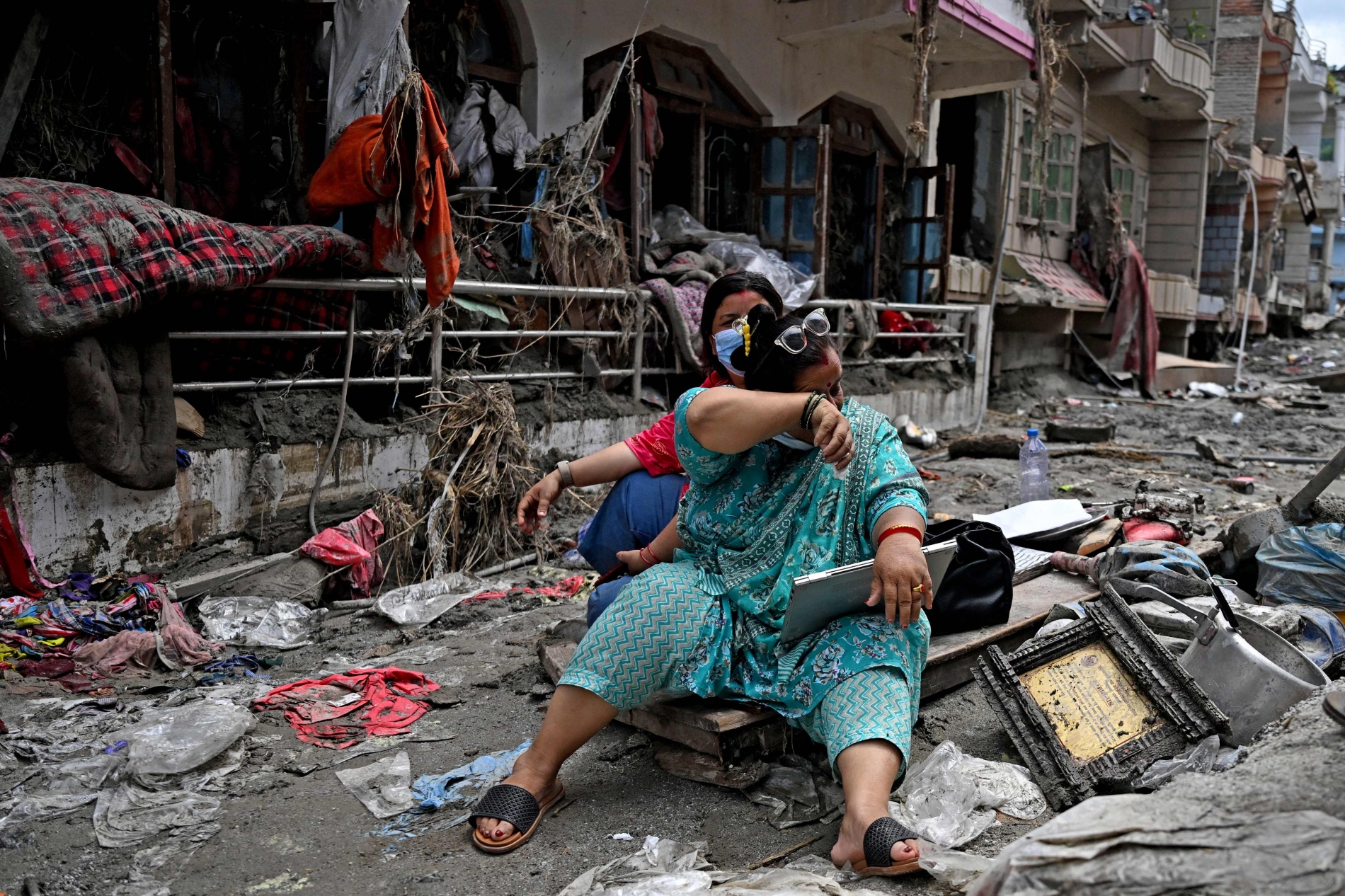
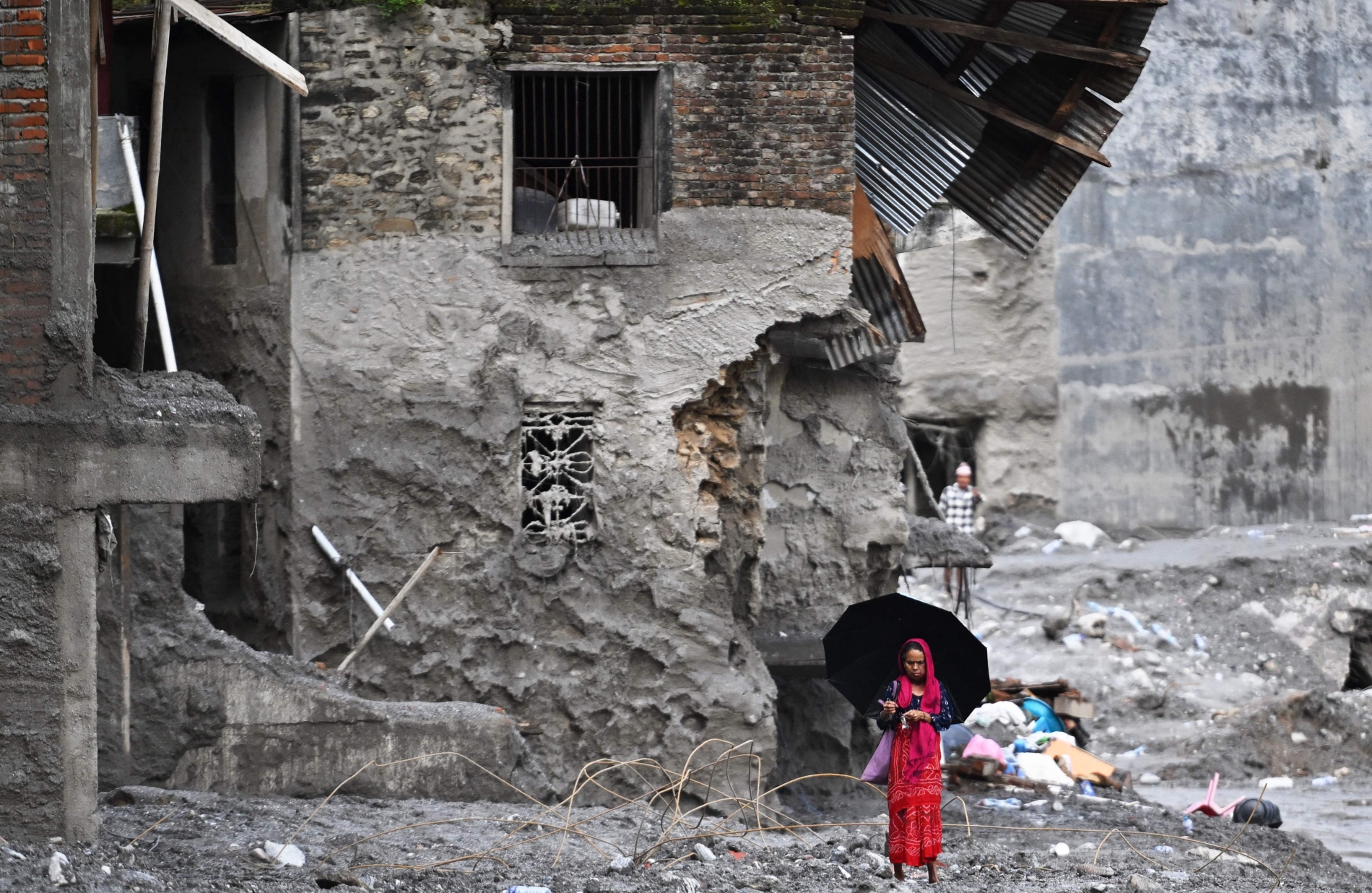
By the time the ferocious waves reached downstream districts, they had turned into a muddy slush, swallowing person after person and house after house.
Bhakta Bhandari from Devighat in Nuwakot—one of the worst-hit communities—was working on his farm that morning when a neighbour sounded the alarm. He had just started running when the waves violently tossed him into the air before he landed in neck-deep muddy water, injuring his back. I visited him at a Kathmandu hospital, while his wife lay in a bed beside him with severe arm and neck wounds. One of his relatives, he suspects, is missing, with another one dead.